First impressions are everything.
Raise media offers a variety of enterprise level services to businesses of any size. Investing in professional photography and videography is an investment in your brand's future. It ensures you are not just seen but remembered.
Here are a few of the services we offer.
Orthophotography / Mapping
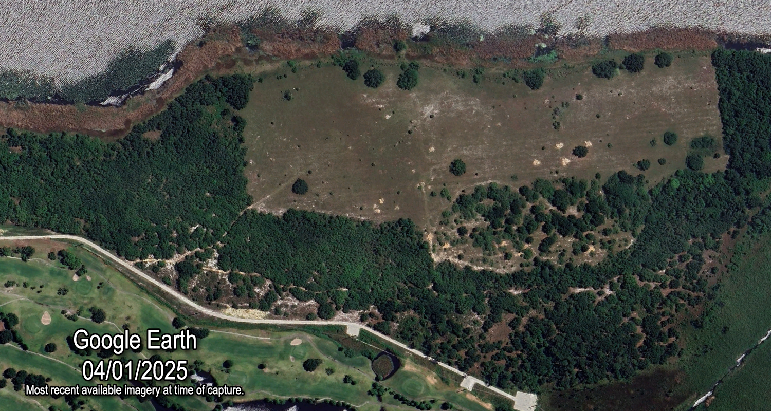
Orthophotography offers precise, distortion-free aerial images of the Earth's surface, essential for accurate measurements and reliable analysis. Unlike regular photos, orthophotos are true-to-scale, aiding urban planning, land surveying, environmental monitoring, and infrastructure projects. They support cadastral mapping, disaster response, agriculture, and GIS applications. Common uses include tracking project progress, monitoring plant health, and surveying large areas. Our orthophotos integrate seamlessly with Google Earth Pro and most mapping software.
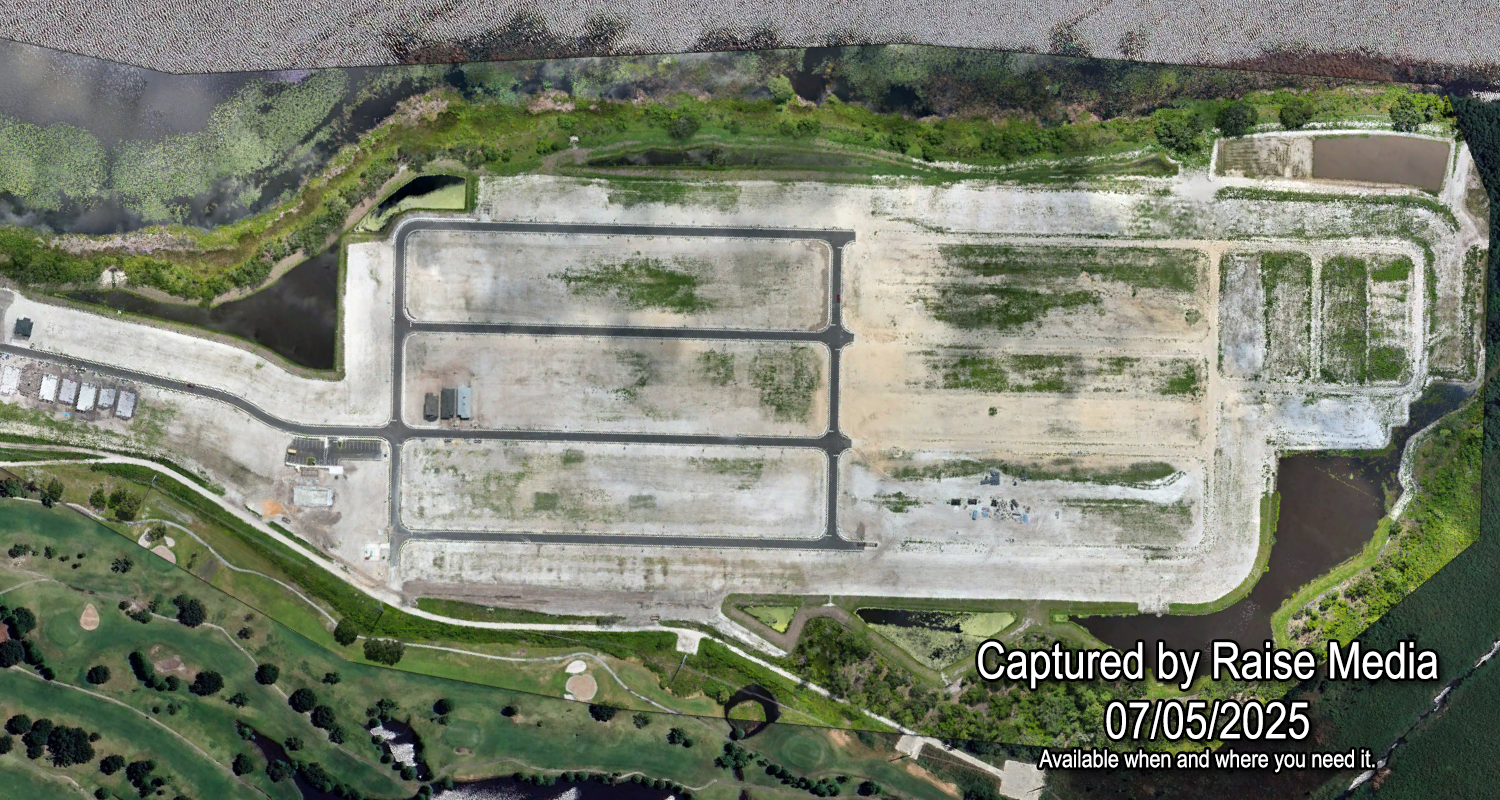
Raise Media, 2.8cm GSD


Maxar

Google Earth

Google Maps
3D / 360 Tours
3D and 360-degree virtual tours offer immersive, detailed experiences that let clients explore spaces remotely, boosting engagement and confidence. They help businesses stand out, overcome physical visit limits, and increase conversions with compelling visuals. Raise Media provides customizable tours featuring spatial audio, floating info prompts, background music, and more, tailored to your needs.
Real estate photography


Quality real estate photography creates strong first impressions, boosting a property's appeal online. Professional images showcase features, increase value perception, and attract buyers, encouraging showings. Poor photos deter interest, prolong listings, and lower sale prices. Clear, well-lit shots highlight space and help buyers envision living there. Investing in good photography makes listings stand out, drives engagement, and speeds up sales.


Project Tracking
Documenting job site progress benefits construction management, client updates, and marketing. Project managers track work, spot delays, and maintain schedules. Stakeholders receive clear updates, boosting trust without site visits. This data aids quality checks, dispute resolution, regulation compliance, and legal protection. For marketing, videos highlight skills and scale, attracting clients. Timelapse videos simplify progress, enhancing oversight and communication. Raise Media uses automated drone flight paths for consistent, comparable results over the life of your project.